Taking in the damage
In the aftermath of the disaster, King Air aircraft and SH-2G(I) helicopters flew over the damaged landscapes and broken roads around the North Island. The dramatic photographs taken on flights gave valuable information to officials on the ground.
01 March, 2023
Click here(external link) for the latest live updates on our response to Cyclone Gabrielle.
The imagery captured was quickly sent to No. 230 Squadron for analysis and information was passed on to the other agencies that are supporting the emergency response.
Squadron Leader (SQNLDR) Craig Clark, from No. 42 Squadron, was on one of the King Air flights and said the sight of the turmoil left in the wake of the cyclone was shocking.
“On SH2 between Opotiki and Gisborne there were a lot of slips that had already been cleared and a lot of damage to the road that was being worked on. On an alternative back road to State Highway 35, between Gisborne and Wairoa, there were some big slips that had made the road impassable that hadn’t been cleared yet.
“I’ve also seen images from the other flights and it was amazing to see the scale of the damage, and how wide spread it was across the East Coast.”
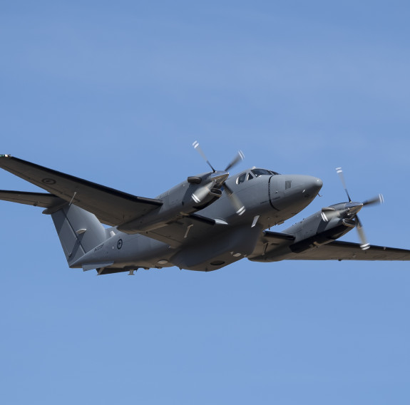
King Air aircraft
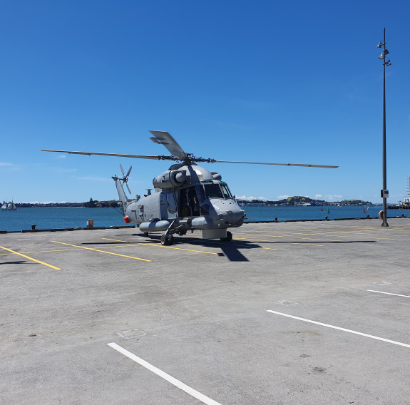
SH-2G(I) Seasprite helicopter
This type of work was unprecedented for the King Air crews, which made the missions even more rewarding SQNLDR Clark said.
“It required quite a lot of work and a combined effort from No. 42 Squadron, the Directorate of Operating Airworthiness, No. 230 Squadron and Headquarters Joint Forces New Zealand. Everyone had to pitch in to get it across the line to make it safe and effective for us to go and do those missions.
“We had been expecting to do some maritime patrols and were preparing for that. To pivot to doing overland damage assessment was something that involved quite a lot of careful thought and planning.”
No. 6 Squadron’s Lieutenant Commander (LTCDR) Terry Rawhiti said two Seasprites were involved in the missions. The flights started after the Auckland floods in late January and continued following the cyclone.
“We also transferred supplies from Auckland to Shelly Beach and South Head,” he said.
“During the reconnaissance flights we were looking for damage, flooded areas, people needing help and rubbish. After the floods there were quite a lot of slips and debris. As people started to recover from those there was a lot of dumping of household rubbish.
“After the cyclone we flew over Coromandel and Thames area. Also the West Coast from Raglan up to Muriwai. The west Auckland area was pretty bad, a lot of main highways were covered in slips.”
The flights were fulfilling, LTCDR Rawhiti said.
“We can’t cover as big an area as the P-3K2, but we do reconnaissance flights quite often, but maybe not as often as we would like. It was good for our unit because most of our work is done on ships, but seeing us contribute to the efforts here is rewarding.”
A No. 230 Squadron Intelligence Officer said the team has worked long shifts, spanning 18 hours a day, analysing the imagery coming to them from all the aircraft in order to quickly get the relevant information to the National Emergency Management Agency (NEMA) and other relevant organisations, via Joint Forces New Zealand.
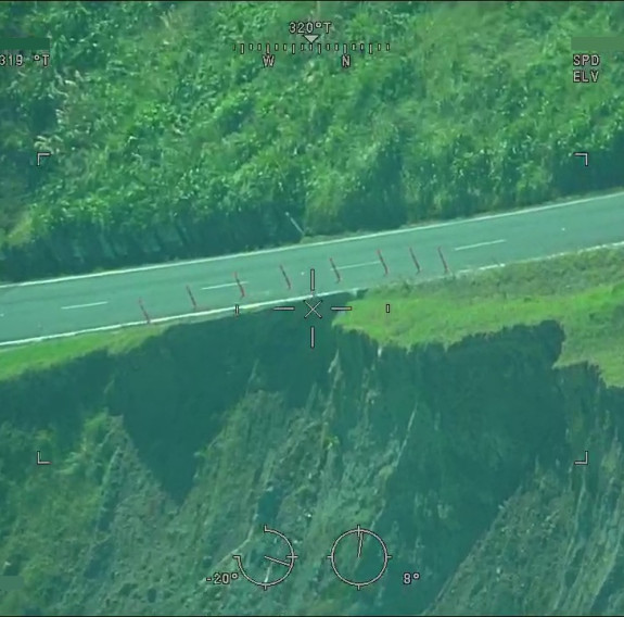
Imagery captured by the King Air aircraft and SH-2G(I) helicopters shows the damaged landscapes and broken roads around the North Island.
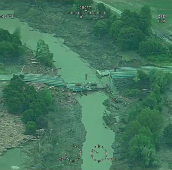
Imagery captured by the King Air aircraft and SH-2G(I) helicopters shows the damaged landscapes and broken roads around the North Island.
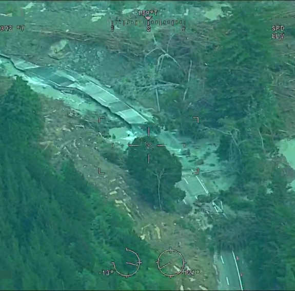
Imagery captured by the King Air aircraft and SH-2G(I) helicopters shows the damaged landscapes and broken roads around the North Island.
“Our priority has been to get the imagery that has come directly from the aircraft to the people who need to make decisions about where resources need to go.
“We have been working up initial damage assessments - so looking at towns or highways for slips and flooding and flood damage. We can then give that first big picture overview of where has the worst damage so that NEMA can decide where resources should go,” he said.
“It’s been an interesting challenge. The immediate turn-around has been the priority - it’s not about spending ages getting the perfect product out, it’s about getting the information out so the NEMA planners can use it quickly.”
The officer said the type of contribution to the disaster response from No. 230 Squadron Intelligence Flight was specialised.
“It’s been fulfilling to lean into that, using our skillsets to support fellow New Zealanders in a time of need. It’s been confronting looking at the scale of the damage.”