How Royal New Zealand Air Force P-8A Poseidon crews train for disaster
The crew of a Boeing P-8A Poseidon recently took off from Base Ohakea and was quickly skimming over the Bay of Plenty, its crew tasked with evaluating the damage from a hypothetical cyclone hitting one of our Pacific neighbours.
21 May, 2025
The RNZAF’s four Poseidons can conduct a range of tasks including aerial surveillance of vast areas such as the Exclusive Economic Zone, the South Pacific and the Southern Ocean. They are also used to support the community and our neighbours with contingency capability for tasks such as search and rescue and support in the event of natural disasters.
Practicing a quick response to a call for assistance
This HADR training mission focused on the crew responding quickly to a call for assistance from a Pacific nation. In this scenario, the nation was simulated by the coastal towns of Ōpōtiki and Whakatāne.
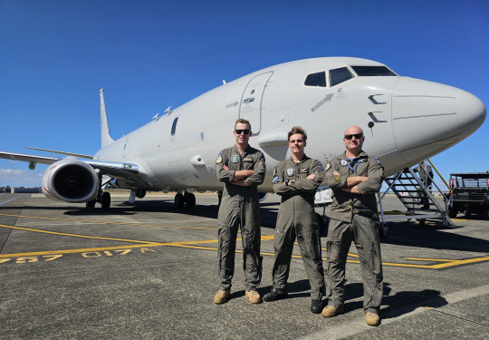
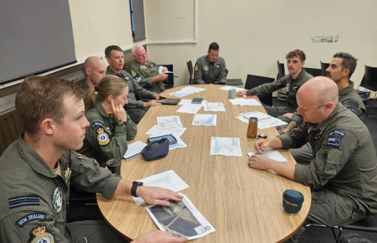
For this scenario, 10 crew were aboard: three pilots, three air warfare officers (AWO, traditionally known as navigators) and four air warfare specialists (AWS).
The Captain, Flight Lieutenant Stu Glendenning, says an air warfare specialist’s primary role is operating the aircraft sensors including radar, electro-optics, infrared cameras, and the electronic and acoustic warfare equipment we have on board. The lead warfare specialist specialises in anti-submarine acoustic warfare, the other three are electronic warfare specialists.
“Once airborne, intelligence analysts in the Poseidon Operations Centre generate ’targets’ for our crew to go out and assess damage using the techniques that we use in a real-world disaster.”
The Poseidon’s advanced systems include a high-resolution camera, which can capture imagery of moving targets, and images from further away than the previous P-3K2 Orion.
Focus on damage to critical infrastructure
The crews focus on any damage to infrastructure such as airfields, hospitals, bridges and roads.
“After the earthquake in Vanuatu last year we made our way there with no information. While we were in transit the crew received a list of targets to start analysing and to feed back to the Vanuatu and New Zealand governments,” Flight Lieutenant Glendenning said.
High priority information and imagery is transferred via a high-tech communication system.
“This is critical as we may have a C-130J Hercules waiting in New Zealand loaded and ready to deliver personnel, medical supplies, food and water to people injured and in need. They need to know if and where they can safely land.”
The information gathered by the Poseidon enables important decisions to be made on the best way of deploying aid – by Hercules, ships, or in some cases an NH90 helicopter deployed from a ship.
“It takes us around six hours to fly to Vanuatu and back, which leaves us enough fuel to map critical infrastructure for around three hours. If we need to stay in the air longer, we will land at another Pacific Island such as Fiji, to refuel and resume the mission.”
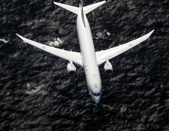
The RNZAF's four Poseidons can conduct a range of tasks including aerial surveillance of vast areas.
Imagery of enormous damage to infrastructure after Cyclone Winston in 2016
“Imagery taken from a P-3K2 Orion immediately following Cyclone Winston – a Category 5 cyclone which hit Fiji in 2016 – showed the world the enormous damage to infrastructure with buildings flattened and key roads flooded.
“Fiji declared a state of emergency and New Zealand, Australia and other nations responded with aid and hundreds of tonnes of supplies.
“We later learned that 44 people had been killed, and more than 40,000 houses had been damaged. This is the type of HADR event we have in the back of our minds while training. Getting the right information in a timely manner is essential to ensuring the right support is available to those in need,” Flight Lieutenant Glendinning said.
Same procedure for Search and Rescue missions
Crews would follow the same procedure for extended Search and Rescue (SAR) missions.
Once the crew successfully completed the HADR portion of the day’s training, a SAR exercise began, using a deployed sonar buoy from the rear of the aircraft into the water to simulate a fisherman overboard wearing an orange lifejacket.
“New Zealand has one of the largest search and rescue areas in the world – covering about 30 million square kilometres of ocean around the country. Searches can stretch from Antarctica to north of the equator. It can be incredibly difficult to locate what is essentially a pinprick,” Flight Lieutenant Glendinning explains.
“While we (the pilots) knew where we dropped the buoy, we wanted the crew to experience the difficulty of locating it and accurately fixing its location. We are flying an aircraft 150 metres above the ocean at almost 400km/h. There are a lot of lessons for the crew to learn in being able to look out the window and spot a lifejacket in the water when the world is moving past at a football field every second.
“Research tells us that in good weather at this speed and this altitude, we have a 90 per cent chance of seeing someone in the water. That likelihood reduces with the size of the area being searched.
“We must balance the probability of finding someone with the time we take searching – every minute a person is in the water decreases their chance of survival. We also consider how much fuel we have for searching.”
In a real-life SAR, the Rescue Coordination Centre New Zealand (RCCNZ) would supply information such as a description of the vessel, last known location, ocean currents, weather and wind direction.
Flight Lieutenant Glendenning said this is why a personal locator beacon (PLB) and wearing a well-fitting lifejacket while on the water was so important.
“Knowing how hard it is to spot a person in the water, I would choose a lifejacket with high-visibility colours, reflective patches, a whistle, an attachment point for your PLB and strobe lights. I would go all out on visibility and attracting attention.”
Once the survivor has been located, the crew quickly turns their focus to rescue. The Poseidon can deploy up to five 20-person life rafts for people in the water if it is unsafe for people to remain on a vessel in distress.
The location of the survivor is reported to RCCNZ and any nearby vessel is contacted by the crew and requested to render assistance. Sometimes this can be immediate and in other cases it can take hours and even days for assistance to reach the survivors. The life raft contains food and water as well as survival equipment and a locator beacon to assist relocation.
The RNZAF’s four Poseidons are used to support the community and our neighbours for tasks such as search and rescue and support in the event of natural disasters.
Surveilling New Zealand’s Exclusive Economic Zone
As well as HADR and SAR, the Poseidon can conduct a range of peacetime tasks including aerial surveillance of New Zealand’s Exclusive Economic Zone – which covers around four million square kilometres of the South Pacific and the Southern Ocean, including the Ross Dependency and Antarctica.
This is done to support a range of government agencies, including the Ministry for Primary Industries, New Zealand Customs, New Zealand Police, and the Department of Conservation.